
Post developed by Katie Brown in coordination with Brian Min.
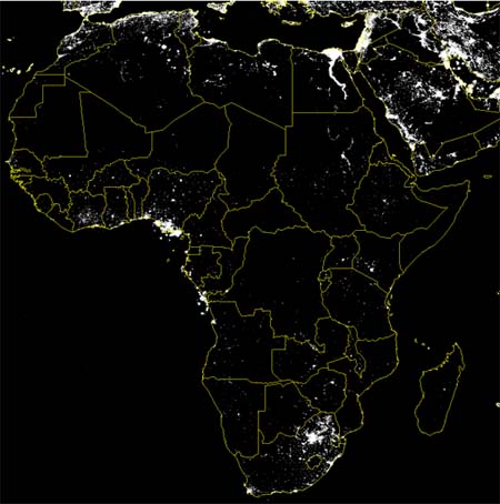
This satellite image identifies nightlights in Africa. The accuracy of maps like this has been validated for developed regions. But how accurate are these maps for smaller villages in developing nations, like Western Africa?
Center for Political Studies (CPS) researcher Brian Min – along with Kwawu Mensan Gaba, Ousmane Fall Sarr, and Alassane Agalassou – tested the efficacy of this imagery. The resulting article, “Detection of Rural Electrification in Africa Using DMSP-OLS Night Lights Imagery,” was just published in International Journal of Remote Sensing. The study is part of Min’s larger World Bank initiative titled “Tracking Light from the Sky.”
The project seeks to test the reliability of DMSP-OLS imagery. The study focuses on Senegal and Mali and consists of two parts. On the ground, the researchers interviewed the chiefs of 202 villages in Senegal and the AMADER operators in 30 villages in Mali about electricity use. These results were coupled with data on 800 unelectrified villages in Senegal and 99 in Mali, as identified via administrative data and paper maps. Then, the data were compared to DMSP-OLS imagery.
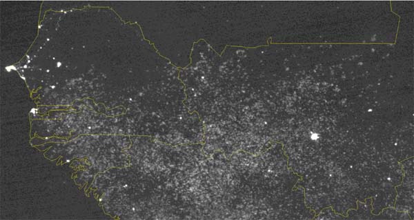
The study finds that DMSP-OLS imagery is indeed a reliable indicator of electricity in villages. But there are some caveats. First, streetlights drive light detection, whereas household electricity does not register as brightly. So, villages with more streetlights appear brighter in the satellite imagery. Second, the imagery is sensitive to weather conditions, especially cloud cover. Finally, the reliability of the images increases when they are composites created over time. For example, the image below shows the two countries – Senegal to the west and part of Mali to the east – over the course of May 2011.
Validating DMSP-OLS as an indicator of electricity in remote villages of the developing world has several implications. First, these images are more cost effective than on-the-ground surveys. Second, these images are captured nightly, creating a natural archive. Third, this allows identification of otherwise remote villages in the developing world.
With DMSP-OLS, the World Bank can monitor existing projects and initiate new projects to enhance global connectivity, communication, and transparency.